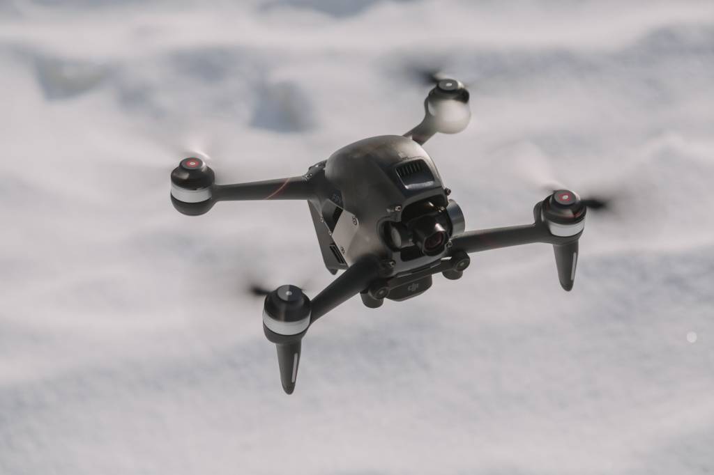
Drones during exercise Joint Viking
Large parts of the airspace over Northern Norway and Trøndelag will be subject to restrictions on civil aviation from 6–17 March 2023. This also includes the use of civilian UAVs, including drones.
Joint Viking is a Norwegian winter exercise held every two years. This March, more than 20,000 Norwegian and allied soldiers will train on defending Norway. The main activity will take place in Troms, Northern Norway in the period 6–16 March 2023.
In connection to the exercise, we have established several restriction zones for civilian aircraft and unmanned aerial vehicles. This means that the use of private aircraft and UAVs in these zones is prohibited without specific permission from the National Air Operations Centre (NAOC). See further down this article for information on how to apply for permission.
The zones have been introduced to ensure flight safety during the exercise. There will be around 50 aircraft and helicopters operating during Joint Viking, and restrictions are necessary to avoid dangerous situations. Maps over the restriction zones can be found in AIP AIRAC SUP 01/23.
The restriction zones apply 24–7 from 6 March through 17 March 2023. The Norwegian Armed Forces will report all violations of the restrictions to the police.
For questions, call the Joint Viking press centre on +47 404 38 083.
Coordinates, restrictions and dispensation
-
Civilian, private flights are not permitted in the area as described below.
The horizontal extent of the restriction areas is limited by straight lines between the following coordinates given in degrees, minutes and seconds in WGS84:
EN R431 Viking East
- 69° 18′ 07.0000″ N – 018° 38′ 44.0000″ E
- 69° 09′ 37.0000″ N – 019° 25′ 05.0000″ E
- 69° 03′ 00.0000″ N – 020° 00′ 00.0000″ E
- 69° 02′ 43.6400″ N – 020° 03′ 35.6900″ E.
Then along the national border between Norway and Sweden to
- 68° 29′ 29.4091″ N – 018° 07′ 06.6340″ E
- 68° 38′ 00.0000″ N – 017° 28′ 00.0000″ E
- 68° 32′ 00.0000″ N – 017° 00′ 00.0000″ E
- 68° 43′ 00.0000″ N – 017° 00′ 00.0000″ E
- 69° 04′ 00.4197″ N – 017° 48′ 46.5367″ E
- 68° 55′ 00.0000″ N – 019° 05′ 00.0000″ E
- 69° 05′ 00.0000″ N – 019° 15′ 00.0000″ E
- 69° 12′ 30.7831″ N – 018° 14′ 01.1609″ E
- 69° 18′ 07.0000″ N – 018° 38′ 44.0000″ E.
EN R432 Viking West
- 69° 33′ 55.4845″ N – 018° 29′ 29.1802″ E
- 69° 28′ 00.0000″ N – 018° 26′ 00.0000″ E
- 69° 26′ 15.0000″ N – 019° 03′ 00.0000″ E
- 69° 18′ 39.4664″ N – 019° 59′ 59.9835″ E
- 69° 03′ 00.0000″ N – 020° 00′ 00.0000″ E
- 69° 09′ 37.0000″ N – 019° 25′ 05.0000″ E
- 69° 18′ 07.0000″ N – 018° 38′ 44.3273″ E
- 69° 12′ 30.7831″ N – 018° 14′ 01.1609″ E
- 69° 15′ 00.0000″ N – 017° 53′ 00.0000″ E
- 69° 05′ 00.0000″ N – 017° 40′ 00.0000″ E
- 69° 04′ 00.4197″ N – 017° 48′ 46.5367″ E
- 68° 43′ 00.0000″ N – 017° 00′ 00.0000″ E
- 68° 32′ 00.0000″ N – 017° 00′ 00.0000″ E
- 68° 38′ 00.0000″ N – 017° 28′ 00.0000″ E
- 68° 33′ 00.0000″ N – 017° 51′ 00.0000″ E
- 68° 29′ 29.4091″ N – 018° 07′ 06.6340″ E.
Then along the national border between Norway and Sweden to
- 68° 24′ 39.2189″ N – 018° 06′ 07.8578″ E
- 68° 29′ 02.8869″ N – 017° 15′ 25.0383″ E
- 68° 28′ 52.0000″ N – 016° 56′ 11.0000″ E
- 68° 33′ 41.0000″ N – 016° 50′ 00.0000″ E
- 68° 44′ 00.0000″ N – 016° 50′ 00.0000″ E
- 68° 43′ 59.9999″ N – 016° 47′ 44.1685″ E
- 68° 46′ 14.4993″ N – 016° 36′ 57.8597″ E
- 68° 50′ 52.1307″ N – 016° 35′ 29.8733″ E
- 68° 56′ 24.9427″ N – 016° 16′ 07.2562″ E
- 69° 05′ 00.0000″ N – 016° 58′ 00.0000″ E
- 69° 20′ 00.0000″ N – 017° 10′ 00.0000″ E
- 69° 25′ 00.0000″ N – 017° 35′ 00.0000″ E
- 69° 34′ 58.8000″ N – 018° 00′ 00.0000″ E.
The vertical extent of the restricted areas is:
- -, EN R431 Viking East: from the ground or water up to 4,500 feet above mean sea level
- -, EN R432 Viking West: from the ground or water up to 2,500 feet above mean sea level.
-
All flights in the restriction zones is prohibited when the restriction zones appear as activated in the NOTAM – unless special permission has been granted by the Norwegian Armed Forces or the Civil Aviation Authority of Norway (CAA Norway).
The ban applies to all aviation including unmanned aerial vehicles and model aircraft – unless other information follows from NOTAM.
The ban does not apply to flights in connection with military, police, ambulance, search and rescue missions, or exercises for such missions.
-
The Civil Aviation Authority of Norway (CAA Norway) can issue an order for an infringement fee according to Section 13a-5 no. 6 of the Norwegian Aviation Act, for infringement of the airspace restrictions in Section 3, cf. Section 2.
-
How to apply for permission to fly in the restriction zones:
- Send an application to the Norwegian Armed Forces by e-mail to naoc@mil.no. This application must be sent at least 72 hours before the scheduled flight.
- The application must contain the following:
- Time period: scheduled start and end of the flight, time in UTC.
- Flight route: description of the planned route, given in coordinates with LAT/LONG in the format DDMMSS. You can also include well-known geographical names if this is relevant for your application.
- Vertical limitations: lower and higher heights are given in feet
- A sketch of the planned flight area or route.
- Type of aircraft: for example airplane, helicopter or UAS/UAV (drones)
- Registration number and/or call sign, if available.
- Description of the activity and the reason for the flight.
- Contact info: person/company, operator, phone number we can reach you.
We cannot guarantee that your application will be approved. The flight must have a certain societal benefit, and there must be no other planned military activity in the same area at the same time. An officer from the Norwegian Armed Forces may be present in connection with the flight.